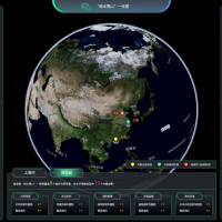
基于卫星遥感大数据、人工智能及数字政府为一体的“绿水青山一张图”服务平台,瞄准自然资源、空间规划、国土资源、城市管理、生态环境、应急管理等应用领域,以“数字可共享、运营智慧化、数据中心化、业务全覆盖”为四大目标,结合“珠海一号”卫星数据采集优势,形成以数据采集、大数据处理和人工智能决策支持为核心的“绿水青山管控决策支持系统”。该系统以准实时、高光谱、多波段的卫星大数据促进“数字经济”发展,提供有效的政府管控及领导决策支持服务。
The monitoring system is applied to carry out rapid and accurate monitoring and analysis of the national ecological environment, natural resources, agriculture and rural areas, emergency management, urban construction, traffic construction and other elements, by mainly use of high-frequency satellite quantitative remote sensing big data (such as hyperspectral data) and assisting with multi-source big data such as aviation remote sensing, ground sensors, mobile Internet, social, cultural and economic data, etc.,
It is also applied to provide decision support for accurate decision-making and fine management of governments at all levels with the support of artificial intelligence technology.
The monitoring system can not only work independently, but also combine the form of components or plug-ins with the existing "digital government" or "smart city" systems in various places, becoming an effective supplement to the existing system, enriching its content and improving its service ability.


